Skip to content

Zuofang Zhang

ePortfolio

Menu
  • About
  • Activities
  • Skills
    • ArcGIS Pro
    • ArcGIS Online
    • Statistical Analysis
    • ArcMap
    • Web AppBuilder for ArcGIS
    • RStudio
    • ENVI
    • QGIS
    • Avenza Maps
    • PyCharm
    • FRAGSTATS
    • FUSION
    • CrimeStat
    • Field Skill
  • Experience
    • Cartography
    • Spatial autocorrelation analysis
    • Land cover/use classification
    • Landscape fragmentation analysis
    • Capability and suitability model
    • Geospatial data analysis in R
    • Land cover change detection
    • Crime analysis
    • Hot spot analysis
    • Digitizing and georeferencing
    • Estimate forest attributes and develop statistical models from LiDAR metrics
    • Time series analysis in R
    • Health geography
    • Interpolation
    • ModelBuilder in ArcGIS

Experience: Digitizing and georeferencing

Digitizing Koh Rong National Marine Park, Cambodia in Google Earth Pro

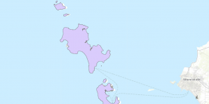
Established in 2018, the Koh Rong National Marine Park is the first marine national park in Cambodia. However, no boundary shapefile can be found online yet, so I digitized it and uploaded the shapefile online.


Brought to you and supported by UBC Arts ISIT


TERMS OF SERVICE