Develop total aboveground biomass (AGB) and dominant tree height model using LiDAR data

Up-to-date forest inventories are essential for achieving sustainable forest management by providing information on forest structural attributes, species composition, and health status. The traditional method to produce forest inventories by conducting field work can be time consuming and costly. The development of LiDAR technique can support the need by characterizing forest attributes in an accurate and cost effective manner.

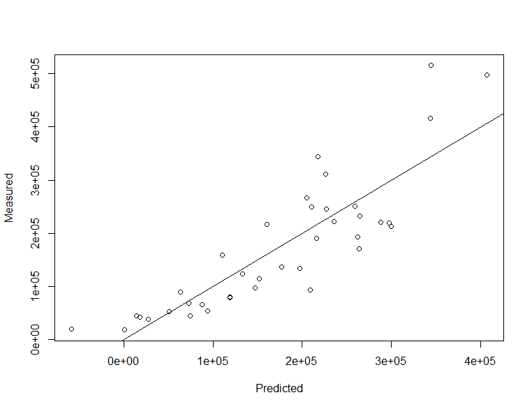
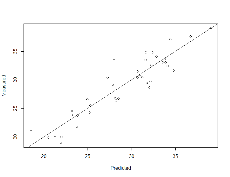
Discrete-return LiDAR dataset was used to develop a suite of LiDAR products for Alex Fraser Research Forest including a total aboveground biomass (AGB) model and a dominant tree height model. Point clouds were derived from LiDAR data to calculate metrics for each field plot. These metrics were then used to develop statistical models using forward variable selection.

Total AGB = -137636.436 + 8347.785*Elev.P25 + 3682.932* Percentage.first.returns.above.2.00

Dominate Height = 10.13847520 + 0.62444342 *Elev.P90 + 0.07145072* Percentage.first.returns.above.2.00

Fig.1 Digital Elevation Model

Fig.2 Canopy height model

Fig.3 Scatterplot of predicted vs. measured values for total AGB model

Fig.4 Total AGB model (red-green: low-high)

Fig.5 Scatterplot of predicted vs. measured values for dominate tree height model

Fig.6 Dominate height model (red-green: low-high)

Share this learning activity with others